Rain, drizzle, fog and humidity across Newfoundland Thursday

Ryan Harding, NTV Weather Centre
Rainfall warning still intact for Newfoundland’s South Coast, RDF wide-spread Thursday
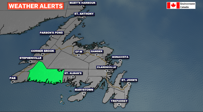
The bulk of Thursday’s consistent rain remains on Newfoundland’s south coast, with a rainfall alert still in place from Burgeo through to Francois bringing a total range of 30-60 mm.
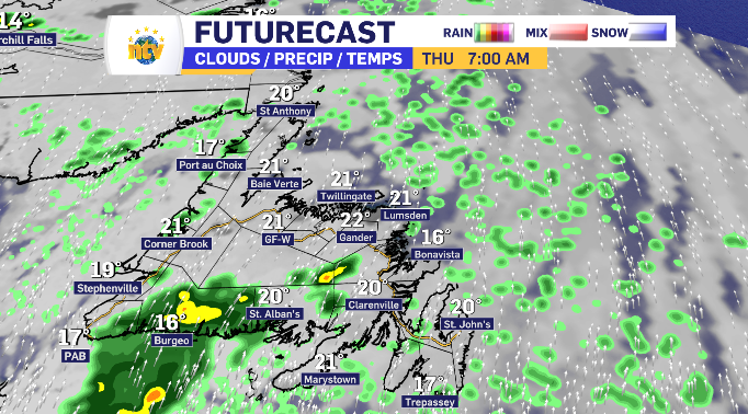
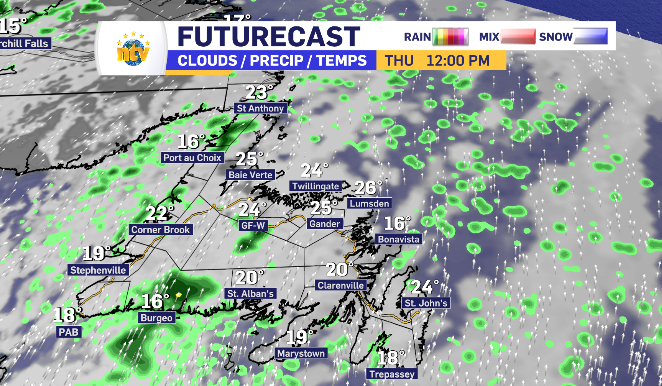
Throughout the day, some light showers break past the coastline and brings brief isolated showers across the West Coast and Central regions.
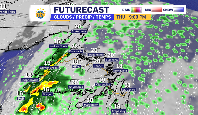
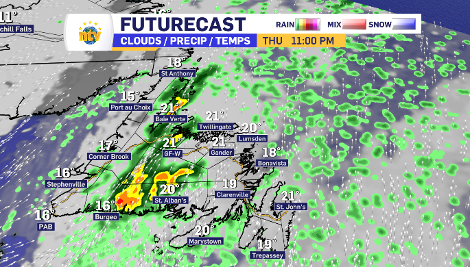
A strong rain hits those regions later into Thursday evening bringing with it 5-10 mm and the chance of some thundershowers.
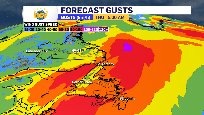
A stronger wind picks up across parts of Newfoundland Thursday as well, on average gusting 40-60 km/h with some gusts reaching 80 km/h along the south-facing side.
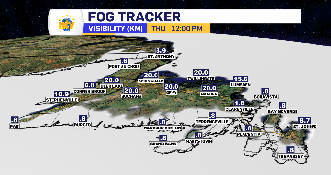
That wind is from the south, ensuring fog on the south-facing side as well.
Eastern Newfoundland clear of significant rain Thursday
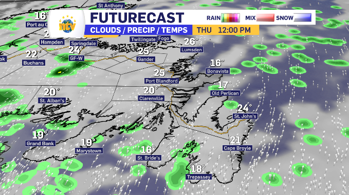
The eastern side of the island will be more so in the RDF category, and more drizzle found hugging the coastlines. There are even some breaks in the clouds throughout the day offering some moments of sun.
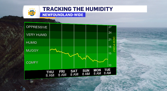
The humidity is equal for all. With 100% humidity, the dew point rises for a few days across Newfoundland, adding anywhere from five to right degrees to the ‘feels like’ temperature compared to the posted daytime highs.
Newfoundland and Labrador daytime highs for Thursday
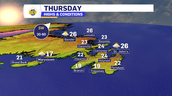
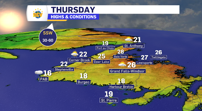
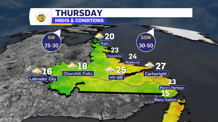
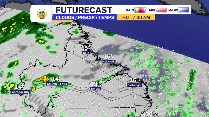
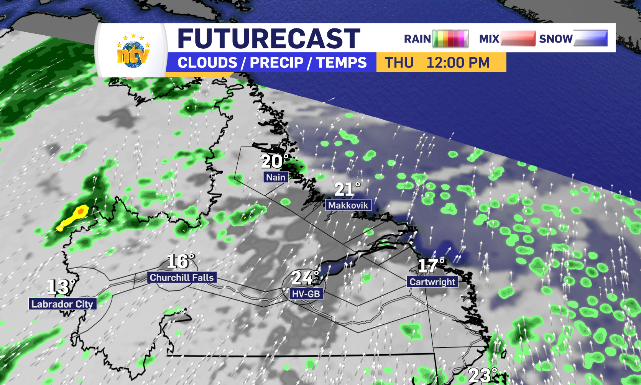
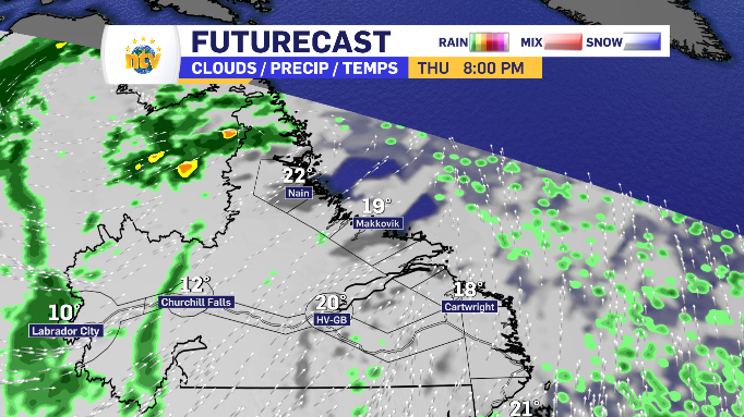
Clearing skies across parts of Labrador throughout Thursday
Labrador West has a modest 2-4 mm to fall throughout the day, with an emphasis on the morning and supper hour.
Central and coastal Labrador starts in the cloud but begins clearing out after the noon hour.
The north coast has a light 1-3 mm to fall near the lunch hour.
A south wind gusting 25-50 km/h keeps Labrador in and around seasonal temperatures, with Labrador West falling slightly behind.