Rainfall warning for Western Newfoundland highlights damp stretch for province Tuesday and Wednesday

Ryan Harding, NTV Weather Centre
Western and Eastern Newfoundland take turns Tuesday and Wednesday with anticipated heavy rain
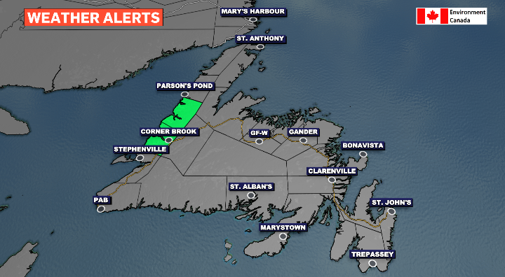
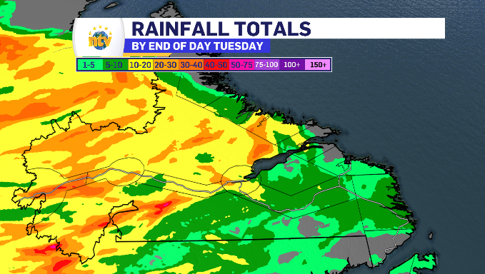
For parts of Western Newfoundland, a rainfall warning has been in place since Monday evening, lasting through parts of Tuesday.
The high-end totals have the potential to range from 30-70 mm, with the rain falling at a rate of 10-15 mm per hour.
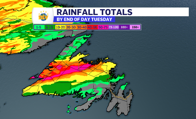
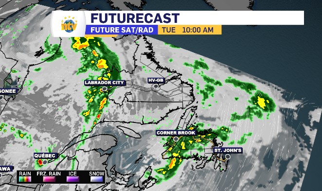
As you can see from the chart above, the rain moves off of the West Coast, into central and finishes on the lighter side over the Bonavista peninsula.
As it starts on the western side, it finishes there first as well, allowing for even some sun by mid afternoon, while the Avalon see’s limited light rain into the evening.
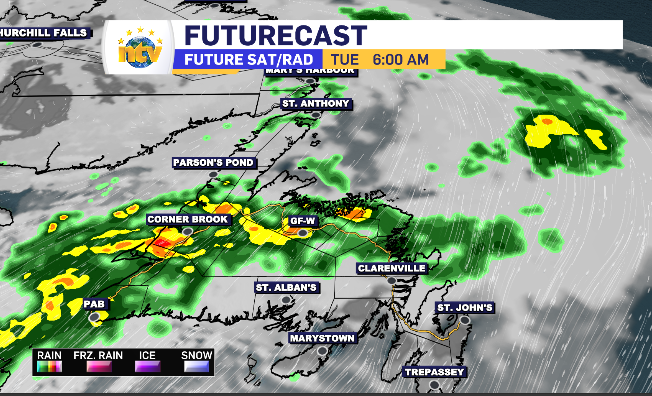
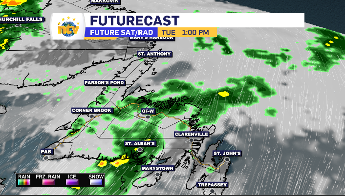
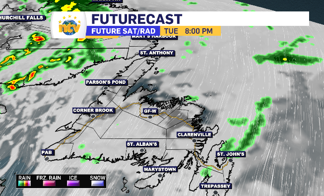
A southwest wind picks up along with the rain, gusting up to 60-70 km/h, while the wind holds in the 20-40 km/h range when not accompanied by rain.
Newfoundland and Labrador’s daytime highs for Tuesday
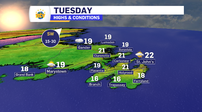
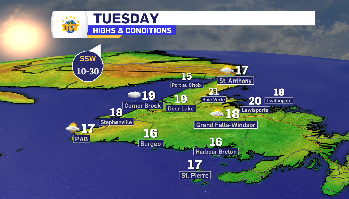
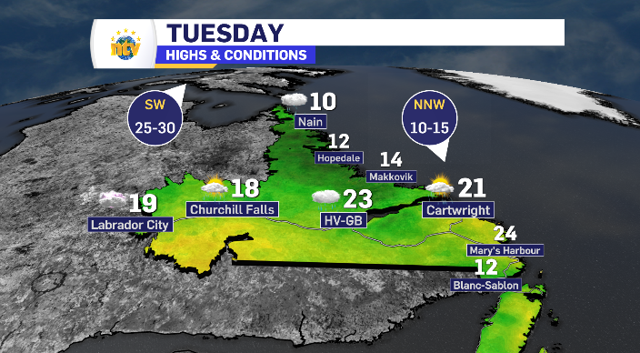
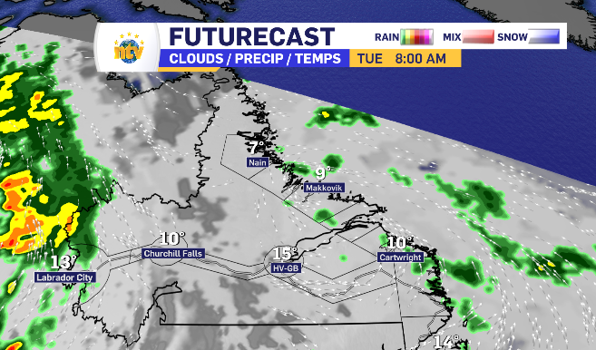
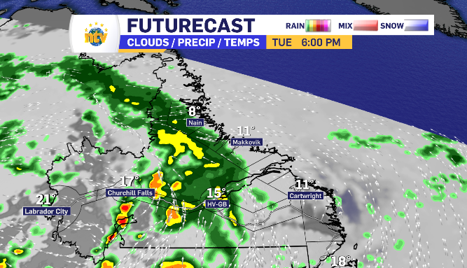
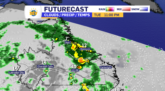
Showers shift around Labrador as well Tuesday
The ranges aren’t quite as high, in the 5-20 mm range, for Labrador’s rain Tuesday. But it too travels west to east and brings with it the chance of some thunder and lightening.
The rain starts light in Labrador West Tuesday morning, increasing by late morning and taking until the supper hour to hit Happy Valley-Goose Bay. From there, through the evening, the rain mostly shift north to the Northern Coast, with limited totals reaching the South Coast later into the evening.