Summary
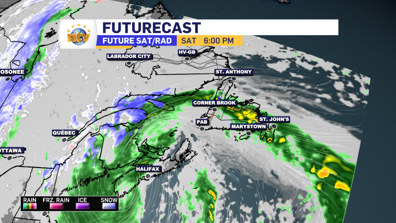
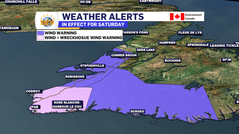
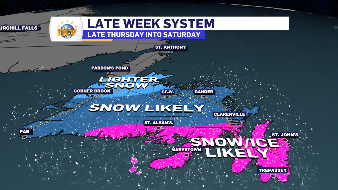
The weather on the Island over the next 24 hours looks quite nice, with no major systems moving through. We will see a chance of rain Wednesday and then a messier system Thursday and Friday that looks to bring a combination of snow and ice to much of the Island south of the Northern Peninsula. The snow and ice from this low may linger into late Saturday.
The late-week storm has the potential to be highly disruptive to everyday life. There is a high likelihood of significant snow and ice amounts for much of the Island. It is still too early to pinpoint which areas will see what and how much of each we will see. Be sure to stay up to date on the latest forecasts, because that will start to get more clear.
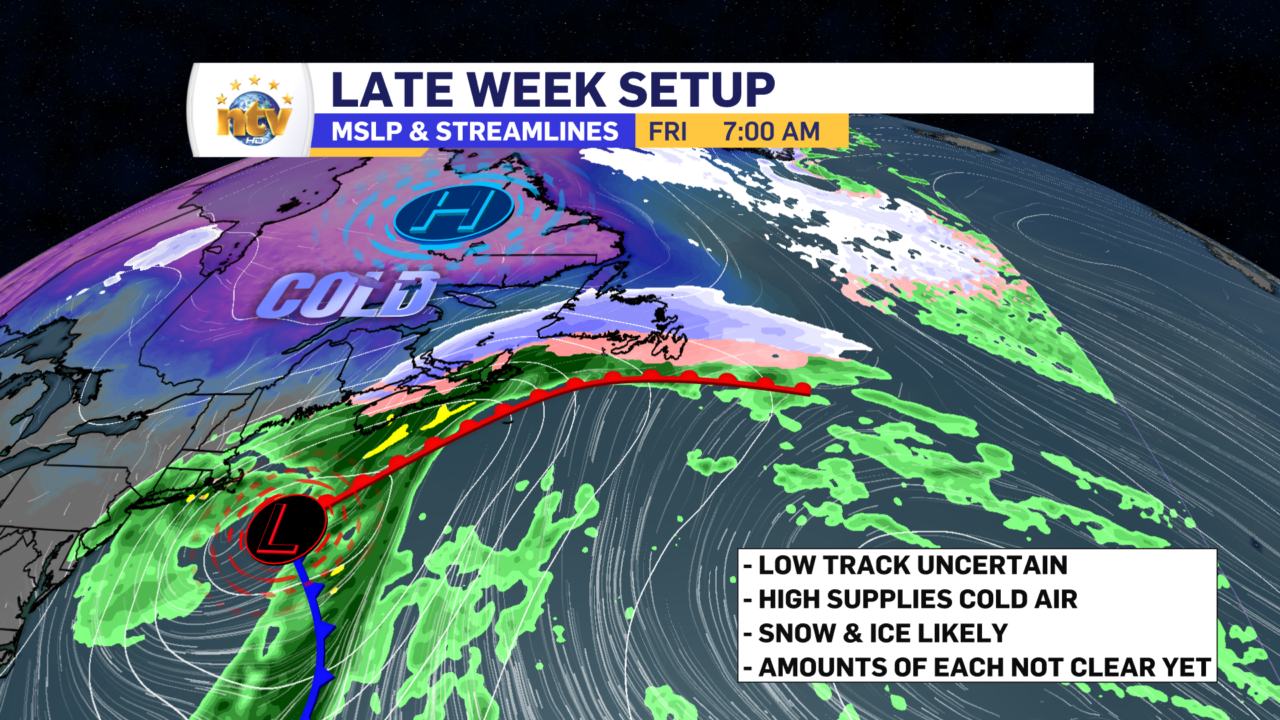
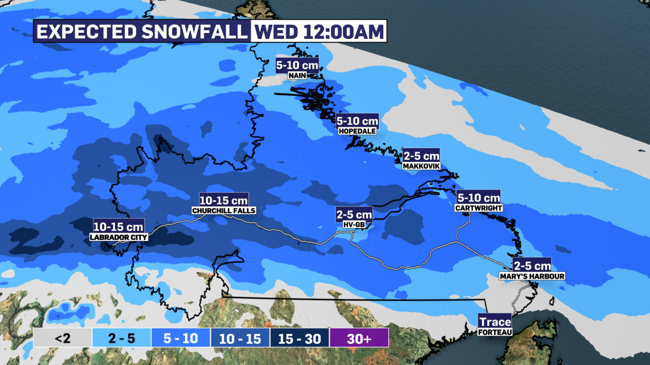
Labrador will see today that will total as much as 10 cm in the west and as little as 3 cm from Cartwright northward along the coast. Areas from Cartwright to the Straits will see very little snowfall in the next 12-18 hours.
Tuesday
Newfoundland
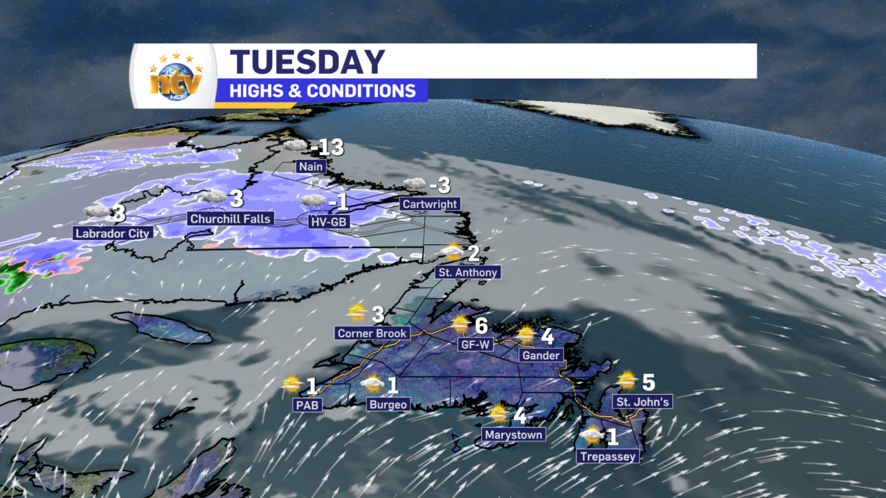
Mostly sunny with highs of 3 to 6. It will be cooler in areas of onshore, southwesterlies. Wind speeds from the west at 40 km/h or less.
Labrador
Periods of snow in the west end as drizzle in the afternoon. The rest of the Big Land will see light snow or flurries. Highs range from +3 in the west to near 0 on the coast and the minus teens in the north.
Wednesday
Newfoundland
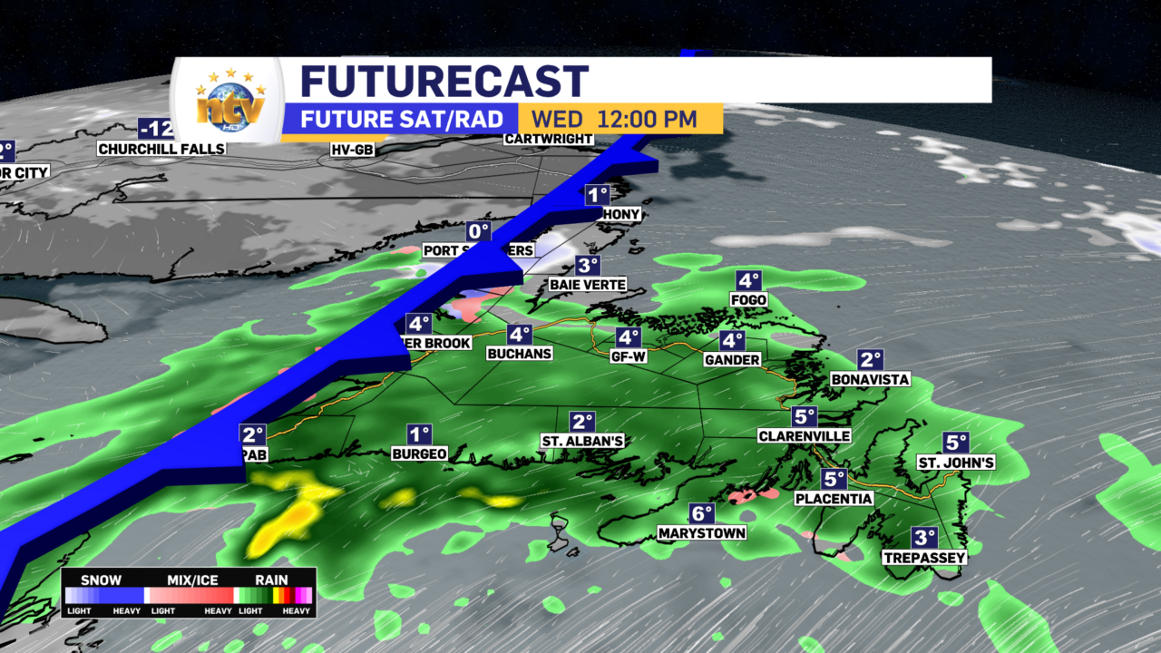
Periods of rain and/or showers. Highs of 6 to 8.
Labrador
Chance of flurries along the coast, otherwise partly cloudy and colder. Highs of -10 in the west and -1 in the east. Temperatures in the east will fall throughout the day toward -10.
Thursday
Newfoundland
Chance of snow by afternoon for much of the Island from the Avalon Peninsula to the West Coast. North of that line it will likely remain dry.
Labrador
Sunny with highs near -10.
Friday
Newfoundland
Snow is likely south of the Great Northern Peninsula. For the Burin and Avlaon Peninsuals there is a chance of the snow changes to ice pellets and/or freezing rain. Highs near or a little below freezing.
Labrador
Sunny. Highs near -7.
Saturday
Newfoundland
Chance of snow for much of the Island west of the Avalon and Burin Peninsulas and south of the Northern Peninsula. On the Avalona nd Burin Peninsuals, there is a the chance of snow, ice pellets and freezing rain. This precipitation will end in all areas on Saturday at some point. Highs will be near or a little below freezing.
Labrador
Sun and cloud with highs near -3.


