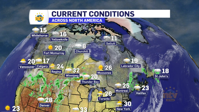

The Next 24 Hours
Aside from some onshore flurries over western Newfoundland, the weather across much of NL will be on the quiet side for the next 24 hours. Expect a mostly clear night for much of the Island, with lows of -5 to -10. Meanwhile, Labrador will see lows of -13 in the south to -16 in the north and as low as -26 in the west. Tuesday will see sunshine over the Island with highs of -2 to -4. Labrador will see sunshine and highs of -10 to -16. Clouds will start to increase for some areas later in the day, and that is a harbinger of things to come.
The Next One
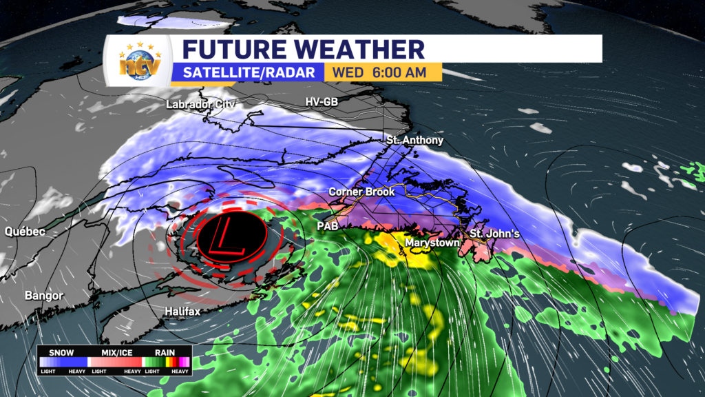
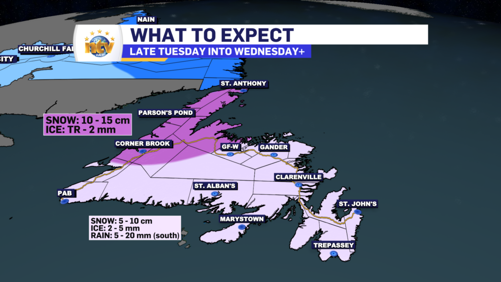
The next area of low pressure will swirl its way through the Province on Wednesday. The low is going to track through southern Labrador, which means Newfoundland is again on the warm/messy side of this low. Snow will arrive late Tuesday night and, after a few hours, will change to ice pellets and then rain from south to north during the day Wednesday. Temperatures will rise from below-freezing Tuesday night to several degrees above by Wednesday afternoon. The change will occur during the morning on Wednesday for most areas of the Island. The only area that may not see a change to rain is the Northern Peninsula.
Snowfall amounts on the Island will not be prolific with this. However, some western and northwestern areas will see as much as 15 cm. Meanwhile, areas south and east of those areas will see as much as 10 cm of snow, followed by ice pellets, freezing rain, and eventually rain. Rain will be heaviest in the south, where up to 20 mm may fall.
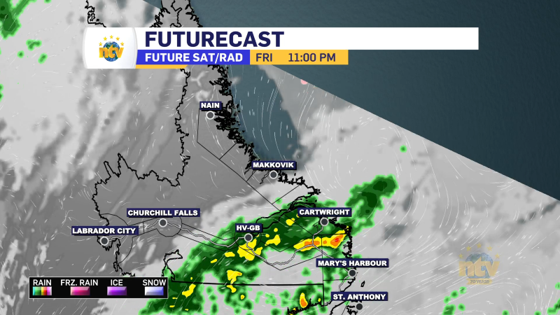
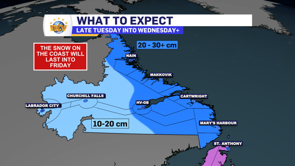
Labrador will see snow from this system, and it will begin Wednesday and, in some areas, will not end until Friday. The initial snow amounts will be seen through late Wednesday or early Thursday, but many areas along the coast will exceed 30 cm by the time Friday evening rolls around and this system finally departs.
The Wind
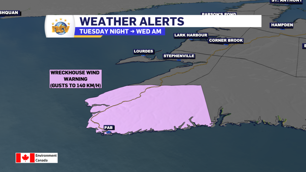
On top of the snow, ice, and rain, there will be some wind from Tuesday night into Wednesday. A Wreckhouse Wind Warning is in effect from Tuesday night into Wednesday morning for gusts as high as 140 km/h. While no current wind warnings are in effect farther north, I expect them as areas of the west coast that see enhanced wind speeds on southeast lies will also see similar wind speeds for a time early Wednesday.
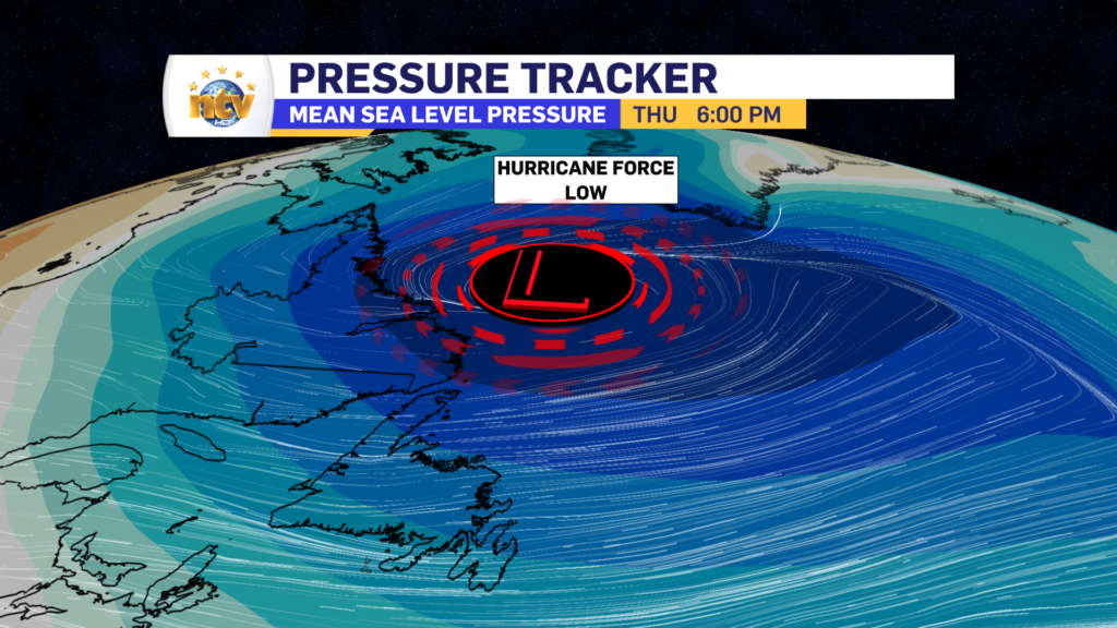
Wind speeds across many areas of Labrador and Newfoundland will diminish for a time Wednesday before cranking back up Thursday and Friday. The reason is the area of low pressure that brings us our initial bout of snow will become a hurricane-force low in the North Atlantic as it stalls in the Labrador Sea through the end of the work week. Gusts of 80 to 100 km/h will be common on Thursday and Friday for much of the Island and coastal Labrador.

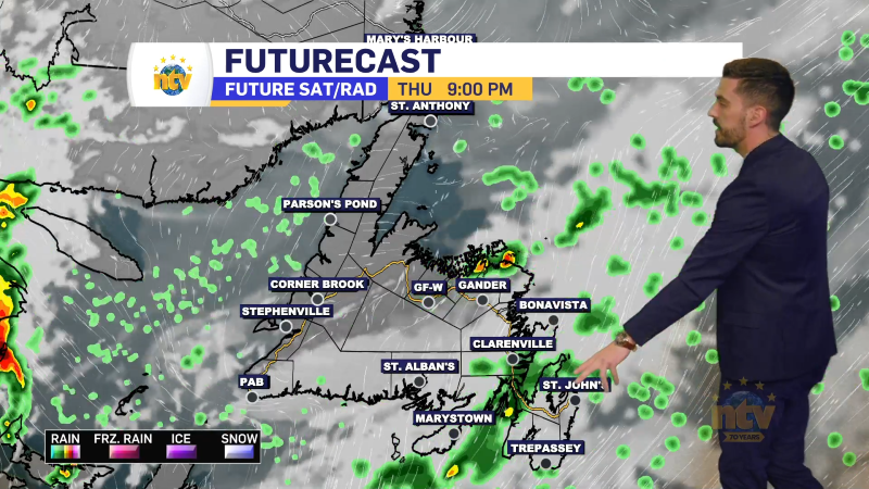
on top of the snow in coastal Labrador, snow squalls will become widespread and intense over parts of western southern and eastern Newfoundland, including on the Avalon, Thursday into Friday. This will make travel locally difficult in areas of falling snow and blowing snow.
More details on this to come.
Have a great night!
Eddie