The Overall Setup
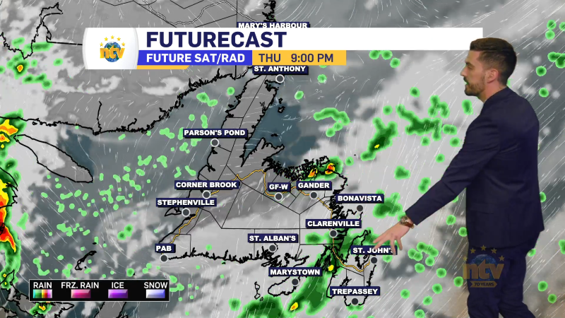
The next 24 hours are going to be quiet across the Province. Most of us will see clear skies overnight and sunny skies for Saturday. Clouds will increase throughout Saturday in Labrador West as our next area of low-pressure approaches from the southwest.

Saturday night will turn decidedly more active across the Province as an area of low pressure approaches from the West. This will spread snow into Labrador and push more high wind speeds into southwestern Newfoundland.

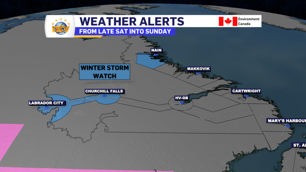
Ahead of this low the ECCC NL Weather Office in Gander has issued Winter Storm Watch for northern and western portions of Labrador from Saturday evening through Sunday for snowfall greater than 15 cm and wind gusts over 60 km/h. Winter Storm Watches are issued when multiple types of severe winter weather are expected to occur together.
A Wreckhouse Wind Warning is in effect from Saturday night through Sunday afternoon for the Wrekchouse area. On top of that, a Special Weather Statement is in effect for areas along the Southwest Coast from near Port aux Basques to La Poile for high water levels around high tide Sunday due to large waves and pounding surf.

Sunday’s Forecast & Beyond
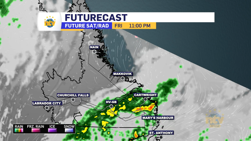
While Sunday will see snow continue in most of Labrador, the Island will see snow, ice, and rain move into western areas early in the day and spread eastward during the day. Central will see the ice and rain arrive mid-morning, and eastern areas will see it later in the day. While the snow will be significant in parts of Labrador, the precipitation that falls on the Island looks far from it due to the low weakening as it moves into the region.
Highs on Sunday will be near freezing over much of the Province as mild air moves in on the east side of the low. Much of the Island will go above freezing while Labrador will stay below.
There are some signs of colder weather moving in later next week, but with that will come an active wetter pattern that may drive more roller-coaster-like temperatures on the Island.