
Tonight’s Outlook + The Northern Lights
The weather across the Province will be relatively calm overnight, ahead of an area of low pressure which will start to swing in Tuesday. Lows will be in the 4 to 8 range in Labrador and 9 to 16 range on the Island. The warmest readings will be in the east and south.

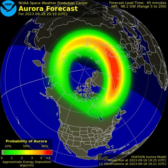
Clouds will be more hit than miss overnight, which is unfortunate because the northern lights may make an appearance over much of the Province. A geomagnetic storm is underway and Kp values may be as high as 6 tonight. While that may not seem like anything important, Kp values of 6 mean that areas as far south in the Province as the Avalon and almost the South Coast, have a chance of seeing the lights IF skies are clear. And tonight that’s a big if.
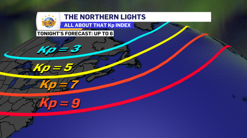
The best way to see the northern lights is to find a dark sky with a clear view of the northern horizon. With respect to tonight, I don’t have an idea of what time may be best yet. I may have a better idea after sunset and the auroral activity starts to swing our way.
Tuesday’s Outlook
An area of low pressure will move from the northeastern United States into the Maritimes on Tuesday, which will push rain onto the Island during the second half of the day. The rain will arrive in the early afternoon on the South Coast and by 6 PM, or a tad later, almost everywhere else. Winds will also be out of the east, so fog is a good bet for eastern coastal areas. Highs will be in the middle teens.
Labrador will see clouds on the increase and scattered showers. However, that’s about it. Expect highs of nearly 7° in the north to lower teens elsewhere.

Tuesday night will see the rain spread across the Island and it will become heavy at times over the eastern two-thirds of it. This will be especially true over the Avalon, Burin, and Bonavista Peninsulas where the heaviest rain looks to fall during that time frame. Rain will also push into the southeast part of the Big Land from Goose Bay to Cartwright, points south.
The rain will ease off Wednesday morning as a warm front lifts north. That will push a short-lived shot of warm and humid air back over the Island, and highs will rise into the upper teens to lower 20s for many of us. And there will likely be some afternoon sunshine.
Meanwhile, rain will continue on the southeast corner of Labraodr and that will not fully taper off until Wednesday night. Highs in Labrador on Wednesday will be in the 8 to 12 range.

Beyond Wednesday the weather looks to remain a bit unsettled for the remainder of the week, and more fall-like and cooler air takes hold. Expect another chance of rain and/or showers on Thursday over the Island, with a dry day on tap for Friday and more showers for the weekend. Highs will dip into the lower teens to close out the week, which means fall-like attire can be broken out!


