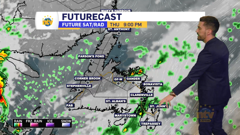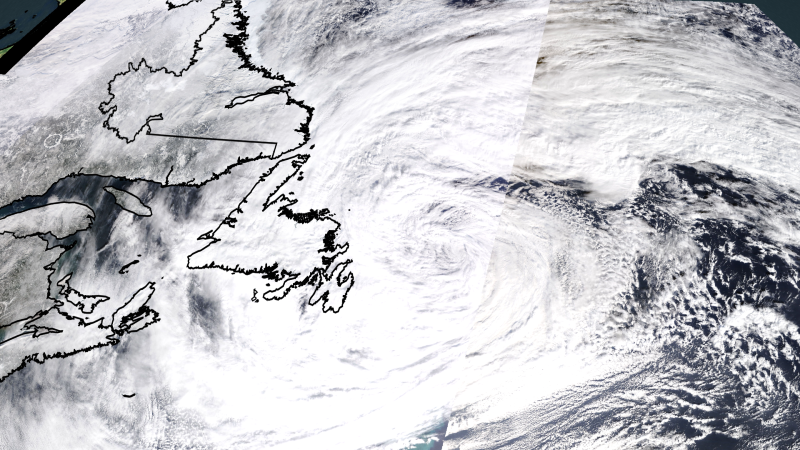
The long-duration winter storm continues this evening across much of the Island and parts of Labrador, but it has started to lose some of its bite. That said, some areas have seen significant snowfall since yesterday morning. Here are some totals as of earlier Thursday evening,
- Gander International Airport: 65 cm
- Paradise: 49 cm
- St. John’s East: 45 cm
- Conception Bay South: 43 cm
- St. John’s International Airport: 31 cm
The snow has been hefty. The observer in Paradise noted that the snow melted to 77.2 mm of liquid. That means we’re getting 1 cm of snow per every 6 mm of liquid (6:1). Typically, that ratio is 1 cm of snow per mm of liquid (10:1). Today’s snow weighs nearly 10 pounds per cubic foot! If you’re wondering why it’s that heavy, that’s why!

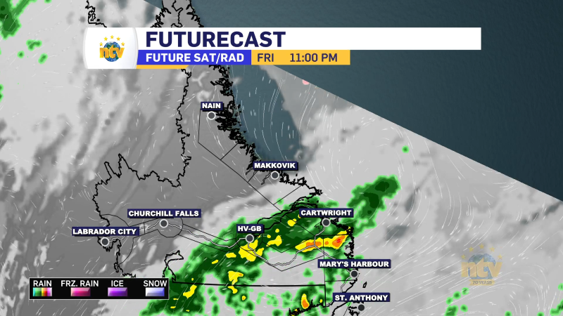
The area of low pressure driving our snowfall will finally drift far enough into the North Atlantic overnight that the snow will end on the Island. Unfortunately, coastal regions of Labrador will see the snow lingering through Friday and perhaps into Saturday. It will end there later, on Saturday or Sunday, as the low finally moves away from its stay near the Province.

Additional snowfall will be 5 to 10 cm for some areas of central and eastern Newfoundland, and that will do it for this winter storm. Labrador will see significantly more snow on the coast by later Friday or Saturday. More than 25 cm will fall on top of what’s already fallen by then.


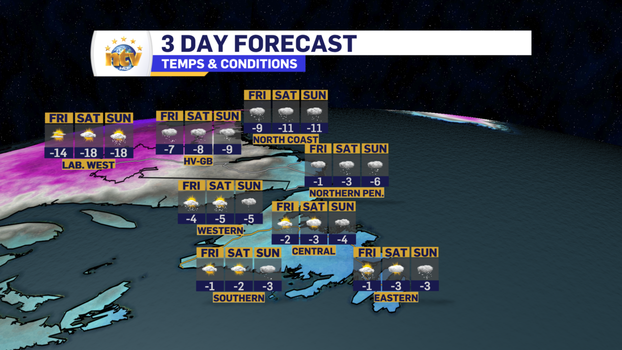
Beyond this, the weather looks fairly quiet across much of the Province for Saturday (minus coastal Labrador). Highs will be on the mild side of things for all but Labrador West over the next few days. The three-day forecast shows that well.
Saturday night and Sunday will see another low passing east of the Avalon Peninsula. This will drive more snow across parts of eastern and Central Newfoundland from late Saturday night through midday Sunday. At this point, it’s still too early to get into amounts, but 15 cm or so looks reasonably likely for areas that see the most snow from this low. I’ll have further updates on this one tomorrow, so stay tuned.