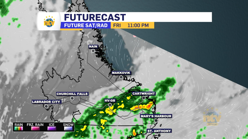
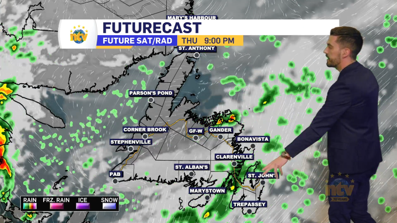
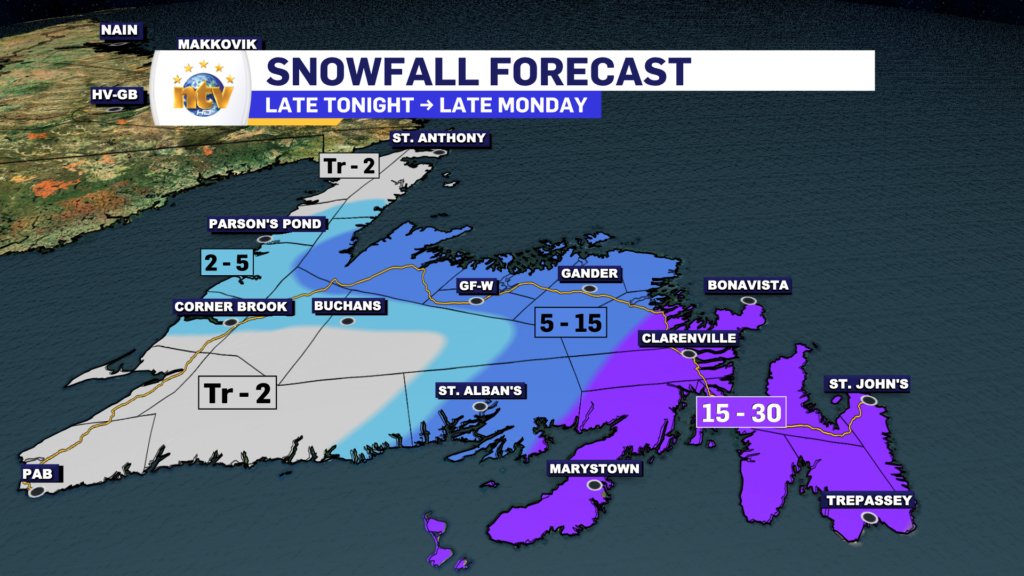
The area of low pressure driving the snow over much of the Island will depart into the North Atlantic overnight. That will end the snow from the west to east during the evening and early overnight hours, and it should be offshore of the Avalon by midnight. As the snow eases, the wind speeds will ramp up, and for some areas, there will be gusts as high as 70 km/h. This will make for locally stormy conditions as the snow will blow and drift around very efficiently in the cold temperatures. Snowfall totals will be as high as 30 cm in the east, with lesser amounts to the west.
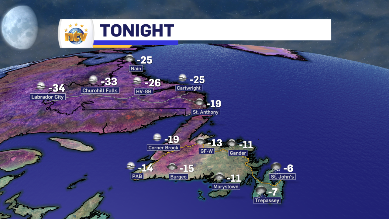
Behind the departing low, it’s going to turn cold overnight across the Island and will be even colder in the BIg Land. An Extreme Cold Warning is in effect for Churchill Falls and Labrador City for wind chills overnight and early Tuesday as low as -55°C!
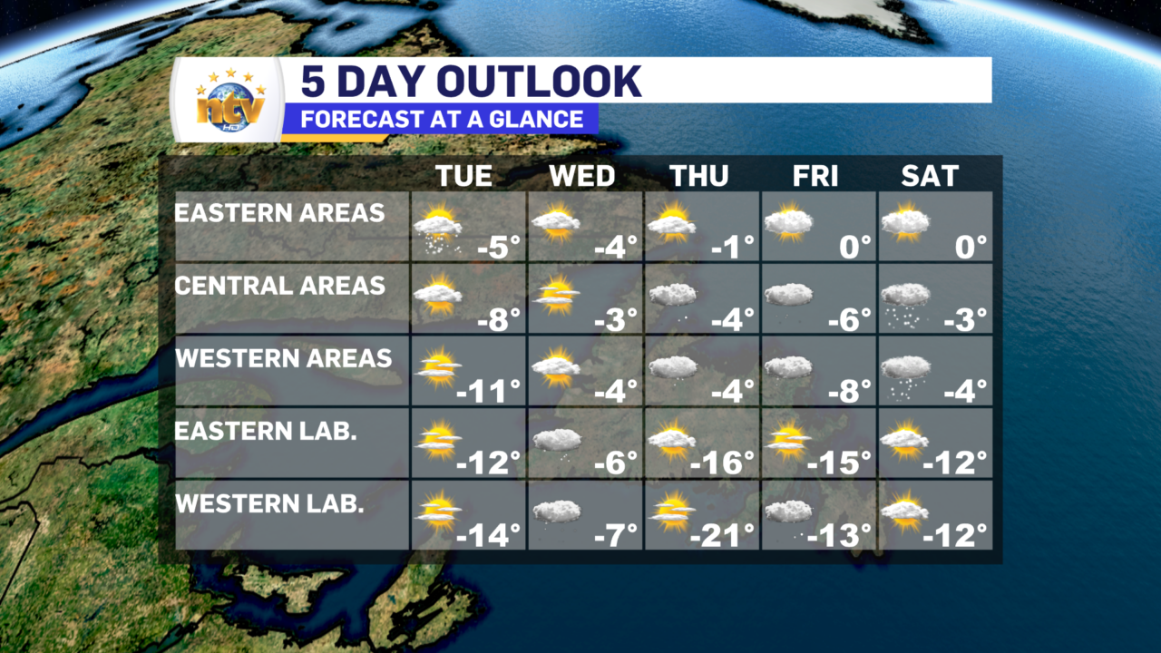
Tuesday will be chilly across much of the Province, with highs in the minus teens. Skies will be sunny for most, although in the east, clouds may linger. IT will be a bit windier for most areas tomorrow as the high-pressure center drifts off from directly overhead.

The rest of the week looks pretty quiet across NL, with only some chances for light snow and flurries through Friday and Saturday. There may be something brewing for early next week, but I’ll cross that bridge when we come to it.