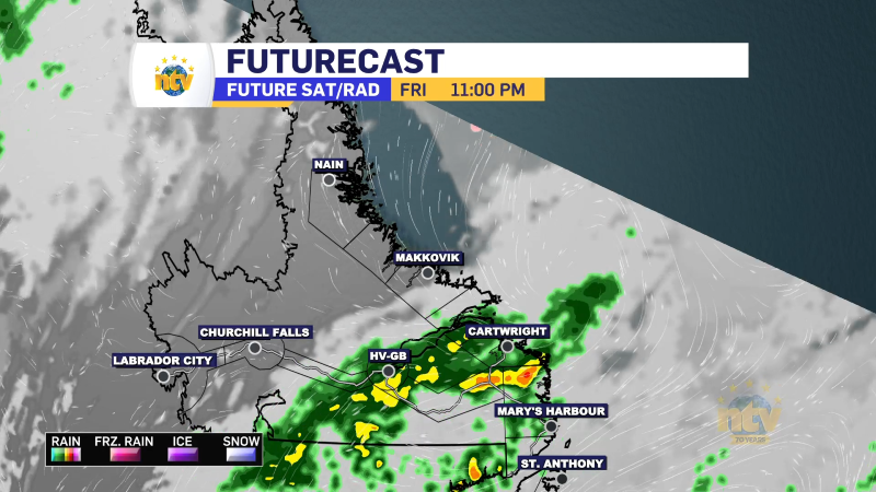
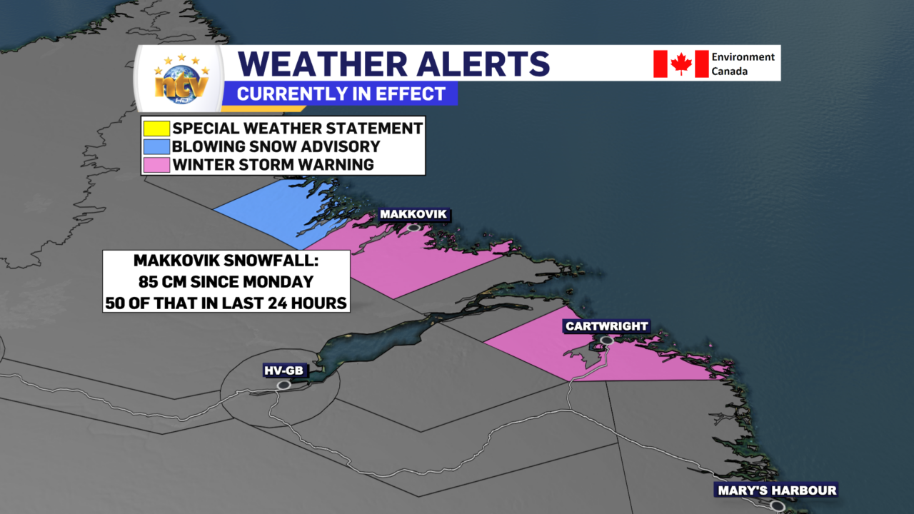
The area of low pressure that drove all the snow and wind across the Island since Wednesday finally moved far enough away that the snow on the Island ended earlier Friday. Sadly, the coast of Labrador is still lashing with waves of snow, and Makkovik has seen 85 cm of snow since Monday, 50 of which has fallen in the last 24 hours!

A winter storm warning is in effect for the Labrador Coast, as is a blowing snow advisory. The snow will continue into late Saturday before finally ending. The weather will improve significantly for Monday.
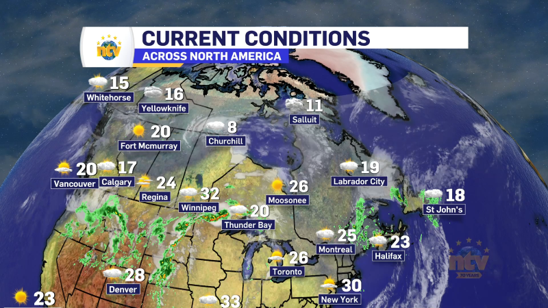
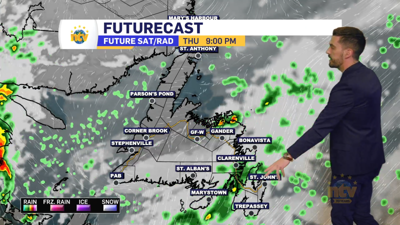
Outside of that, weather-wise, we are looking quiet across the rest of NL through tonight and Saturday. Lows on the Island will be in the minus 3 to -10 range, and Labraodr will be lows of -10 to -30. Saturday will see highs on the Island of -3 to -5, while Labrador will see highs of -7 to -17.


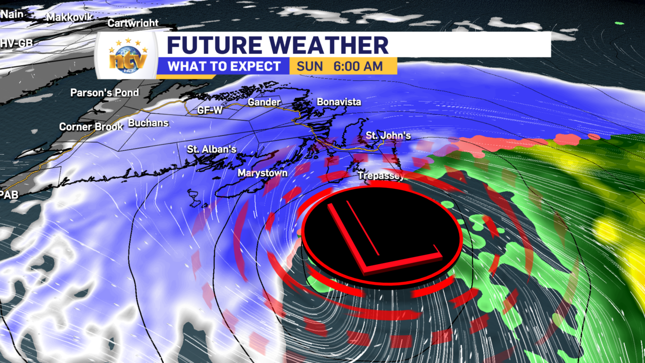
Saturday night our next weather maker moves in. This will be a quick-moving low that passes east of the Avalon Peninsula during the morning hours of Sunday. This will be an energetic little thing and will bring a punch of heavy snowfall to eastern Newfoundland from early Sunday morning through the early afternoon. A Special Weather Statement has been issued by Environment Canada in advance of this low.

This will drop a quick 15-30 cm for areas that see the most snow, with lesser amounts just to the west. There are some questions about where the highest amounts will be, due to the track being a bit uncertain. If the track is just offshore, the highest amounts will be over the Avalon. If the low tracks over the east coast of the Avalon, then parts of the Avalon, including the Metro, will change to rain for a time, and the heaviest snow will be just to the west. Here is my initial stab at snow amounts between late Saturday night and Sunday afternoon. Keep in mind these may change, so check back for the latest forecast.
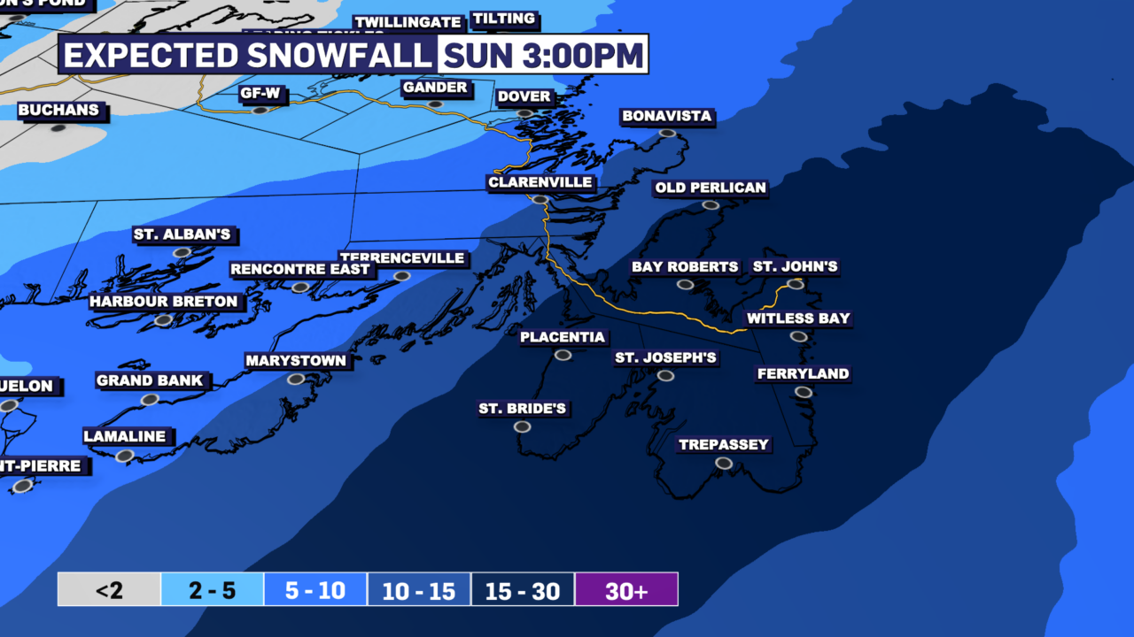
There is also the chance we see a brief period of high wind speeds (>100 km/h) on parts of the Avalon Sunday morning as the low passes by on route into the North Atlantic. This will ultimately depend on the low’s track and how quickly it’s intensifying as it moves by the Avalon. I’ll also have an update on this at some point on Saturday as well.
Sunday will also be colder, so the snow that falls from this low shouldn’t be as heavy for most areas. If we get the chance to rain on the Southern Shore and Metro, it may get there if any rain gets into it.
Check back for details and have a great weekend!