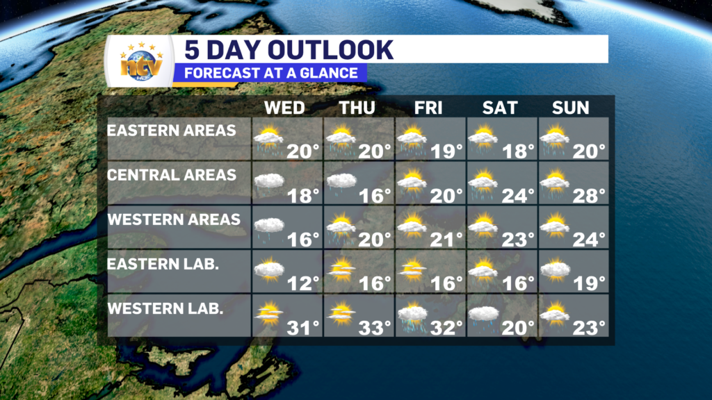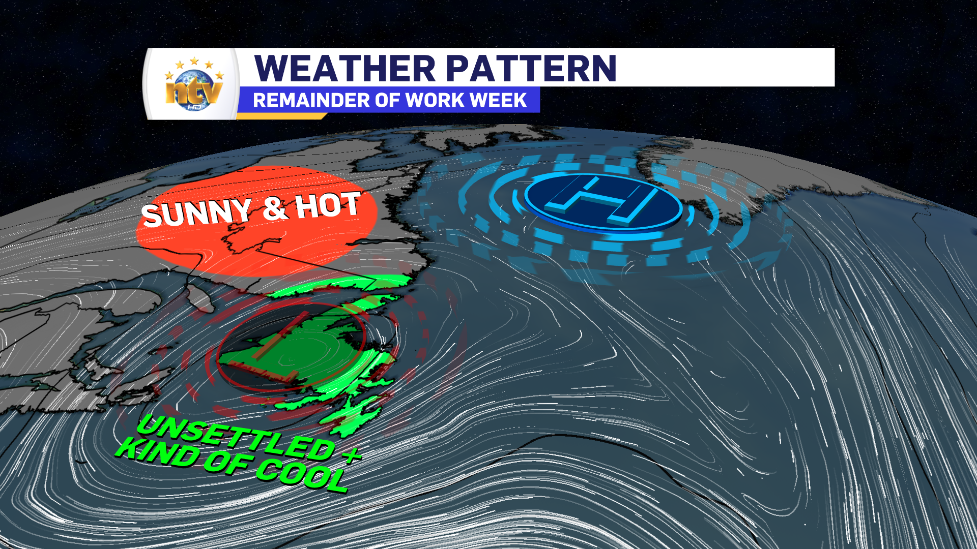
I’ve got good news and bad news. The good news is we are pretty much done with the heaviest rainfall. The bad news is a stubborn and slow-moving area of low pressure is going to keep the weather unsettled across the Island portion of the Province for the next few days. Meanwhile, in Labrador, the heat will be on in the west!
The reason for the large variations in weather is due to the features seen in the map above! We’ve got a cutoff low over the Island, meaning an area of low pressure, in the middle levels of the atmosphere, cutoff from the mean flow. Lows like this meaner about and will keep the weather under them cloudy, cool, and unsettled until getting “kicked” out of their location. This will happen over the weekend.
Meanwhile, above the cutoff low, Labrador will be under a dome of high pressure. This will lead to unseasonably warm conditions, with temperatures running 10 to 15 degrees above normal throughout the work week.

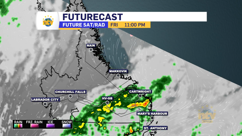
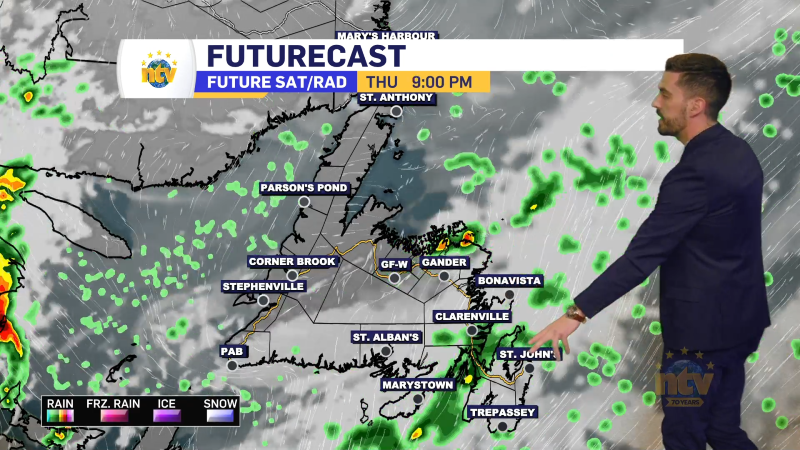
The heat will break in Labrador over the weekend. Some strong thunderstorms will roll in Friday evening, or so it looks now. On the Island, we will see the weather remain unsettled through Friday or Saturday. After tonight, no day looks like a washout, per se. We will just have widespread, on-and-off showers. There will also be some breaks of sun here and there as well. Especially over eastern areas during the next couple of afternoons.