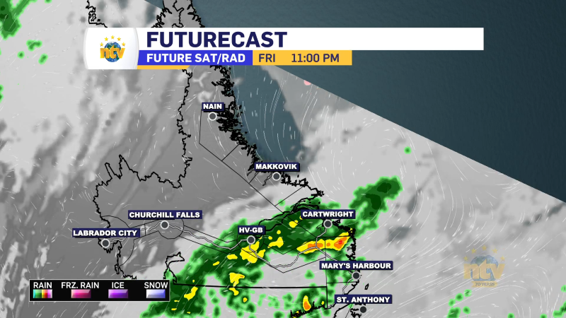
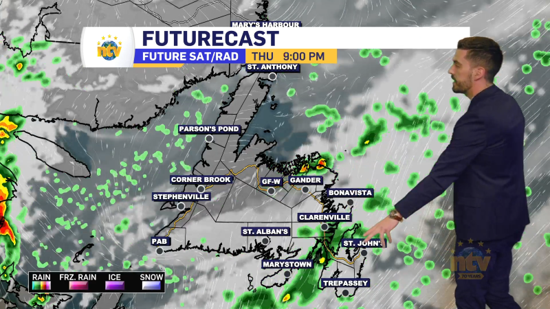
A weak area of low pressure and its associated frontal boundaries are moving across the Island portion of the Province early Sunday morning. This drives rain, some high-elevation snow across the Island, and a mixture of rain and snow in Labrador.
As this system moves northeast of Newfoundland later today, it will take the rain and snow with it. Much of central and eastern Newfoundland will see rain this morning or in the afternoon, ending before the evening. The sun will likely shine for a few hours for the mentioned areas before sunset this evening. The West Coast will see the sun come out early this afternoon. The Southeast coast of the Big Land will also see the snow and rain end, and will get a bit of sun later today as well.
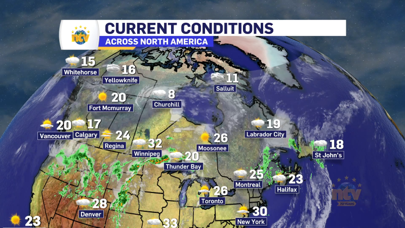
Here is a visualization of today’s weather and temperatures across the Province. This should give you a good idea of how the day will progress once we move into the afternoon and evening. The video will play after the ad.
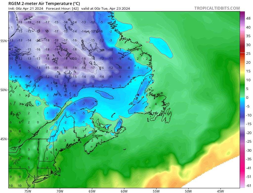
A bitterly cold late-season airmass will move in Labrador West on Monday, and on top of that, a little potent low-pressure center is going to bring some snow to the area. Temperatures are going to be well below freezing for much of the region.
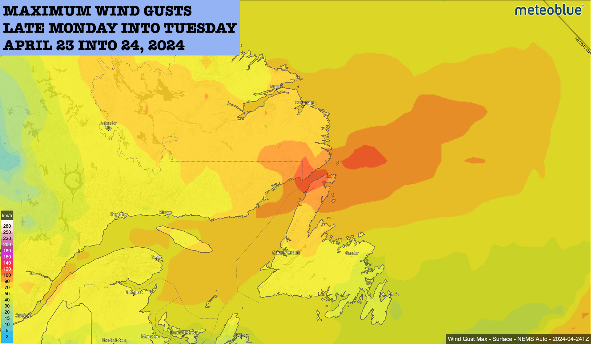
While the snow it brings may not be impressive, the wind it brings will be. I expect 70 to 90 km/h gust over much of the Big Land between Monday afternoon and Tuesday morning. The highest winds will be in the west in the afternoon and shift toward the coast later Monday night and early Tuesday. Winds in the Straits Tuesday morning may gust over 100 km/h. There will likely be some wind warnings issued by the Gander Weather Office.
Stay tuned for more details on this!