Post 3 – 6:43 PM NST (6:13 PM AST)
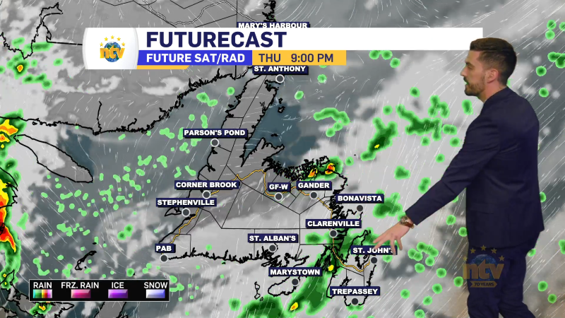
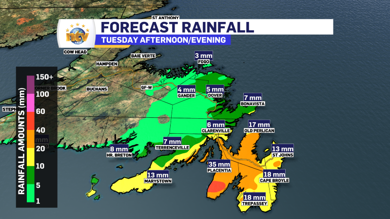
A quick-moving low-pressure center will bring rain and snow to the eastern parts of the Island Tuesday afternoon and evening. I’m expecting heavy rain over the Avalon Peninsula and northeast coast.
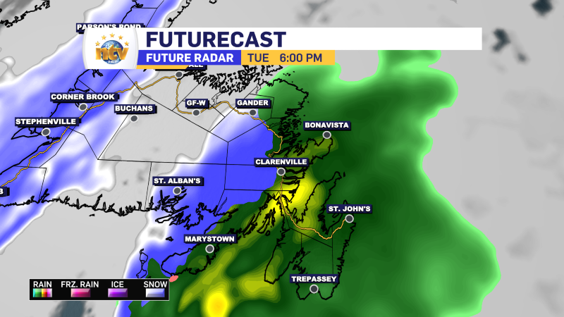
Areas from Gander southward will likely see snow. The Burin Peninsula could be rain, or could be snow depending on where the low tracks. It could be such that western side of the Boot sees snow and eastern side sees rain. The rain and snow move in late afternoon and exit late evening.
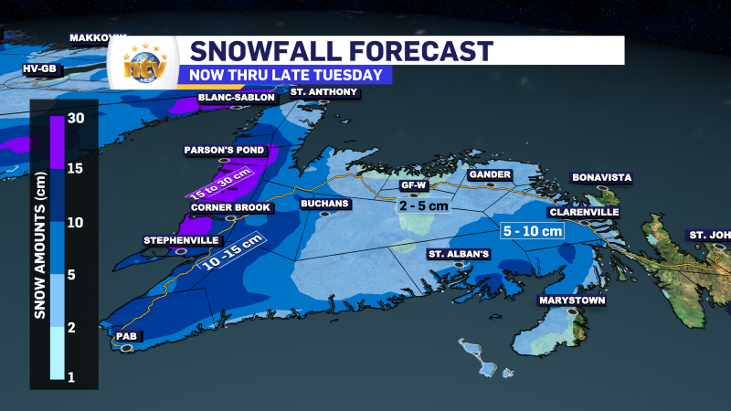
The West Coast will also see widespread snowfall Tuesday afternoon as a cold front moves in. That front will usher in some much colder air for Wednesday. Labrador will see the cold air arriving Tuesday in the west, and Wednesday in the east.
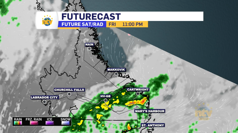
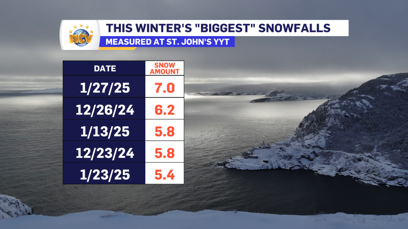
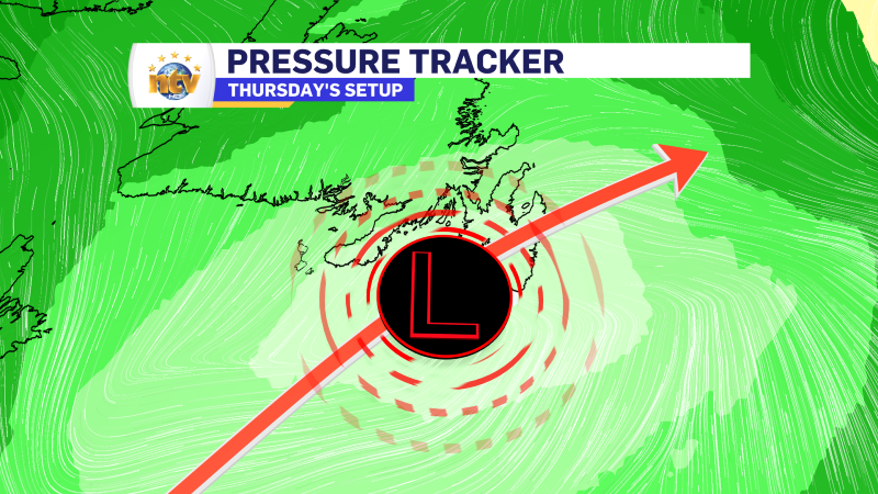
The following system arrives Thursday and could bring the biggest snowfall of the season to the Avalon… which isn’t saying much considering the most significant one-day snowfall total at St. John’s is just 7 cm this winter.
As of this writing, snow will arrive late Wednesday night or early Thursday morning and end early Thursday afternoon. Amounts will be limited because of the fast-moving nature of this low. I think 10 to 15 cm is a good bet for the time being for the Avalon Peninsula and some adjacent areas of eastern Newfoundland. Stay tuned for updates on this one!
Post 2 – 9:44 AM NST (9:14 AM AST)
A band of heavy snow is currently rotating over the Avalon Peninsula, and more specifically, as of this update, it is over the Southern Shore and Metro.
This will last for the next hour or and snowfall may be 2 or 3 cm in some areas during that time. The snow will ease once this passes and travel conditions will improve.
I went over this in a short video earlier and you can find it here.
Post 1 – 6:52 AM NST (6:22 AM AST)
Good Monday morning!
A weak area of low pressure is helping to bring some snow to eastern and southeastern areas of the Island this morning. While the majority of the snowfall is rather light, there are some pockets of moderate to heavy snow over parts of the Avalon and Burin Peninsulas. The snow will end by 10 or 11 AM on the northeast Avalon, and before then to the west and southwest.
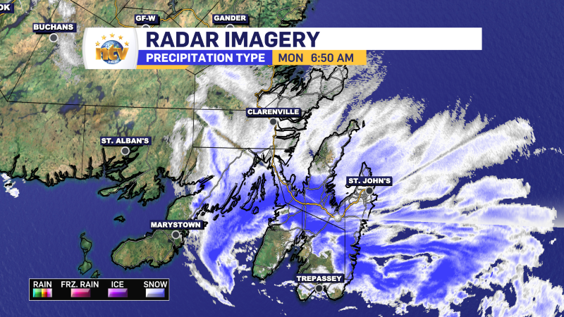
Snowfall amounts this morning will be 2 to 5 centimtres. Roads will be snow-covered and slick for much of the region. Some schools have a delayed opening this morning and that’s mostly on the southwest Avalon and Burin Peninsula.
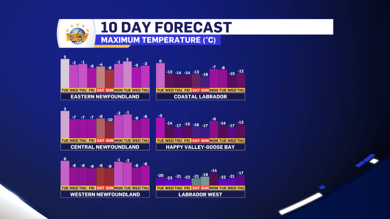
Weather across the rest of the Province looks calm today, and even eastern areas may see the sun once the snow ends later this morning. Highs will be in the minus single digits on the Island and minus teens in the Big Land.
Highlights for the week
- Tuesday
- A quick-moving low will bring rain and snow to parts of eastern and central Newfoundland. Snow will fall west of the Avalon—details later today.
- Wednesday
- Areas of snow squalls on the West Coast with scattered flurries on the South Coast, Burin and Avalon Peninsulas.
- Parts of coastal Labrador will see see some snow and wind
- Thursday
- An area of low pressure will track southeast of, or just over, the southeast Avalon.
- Chance of snow for eastern Newfoundland which could mix with rain on parts of the Avalon depending on track
- Has potential to be the largest snowfall of the winter for the Avalon… which honestly wouldn’t take much.
- Stay tuned for details!
- An area of low pressure will track southeast of, or just over, the southeast Avalon.