An area of low pressure to the east of the Avalon Peninsula dominates today’s weather pictures. This low is part of the system that brought bouts of heavy rain to the southern and eastern sections of the Island on Sunday. Which, if you were like me, made for a not-so-great ride on the highway. The map from windy.com helps visualize the situation.
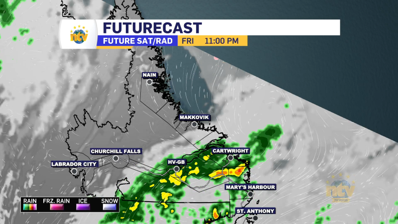
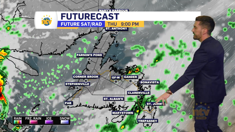
The low to our east will generate lots of northerly/onshore flow across much of the Island and parts of Labrador today. This pattern generally brings cool temperatures, clouds, and showers to areas near and on north-facing shores and today will be no different. In today’s case, the showers will be most prevalent over coastal areas of central and eastern Newfoundland but will be possible as far south as the South Coast. Coastal Labrador will also see some showers to start the day, but they should become less widespread by the early afternoon. The loop from the RDPS model (below) illustrates this point rather well.
The sun will shine at times today but will become more prevalent across much of NL this afternoon as the showers ease and the skies try to clear. However, the clouds will roll back in overnight as the northerly flow continues.
Temperatures will peak in the mid-teens to about 20º across the Province to start the week. We will see a bit of a warming trend for the first couple of days, however, a large area of low pressure will swing in for Wednesday, which brings our next chance of widespread, significant rainfall.
I’ll have an updated forecast for you later today and will see you this evening on NTV News starting at 5:30 PM NDT!
BE SURE TO CHECK OUT OUR NEW WEATHER PAGE IF YOU HAVEN’T ALREADY!