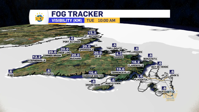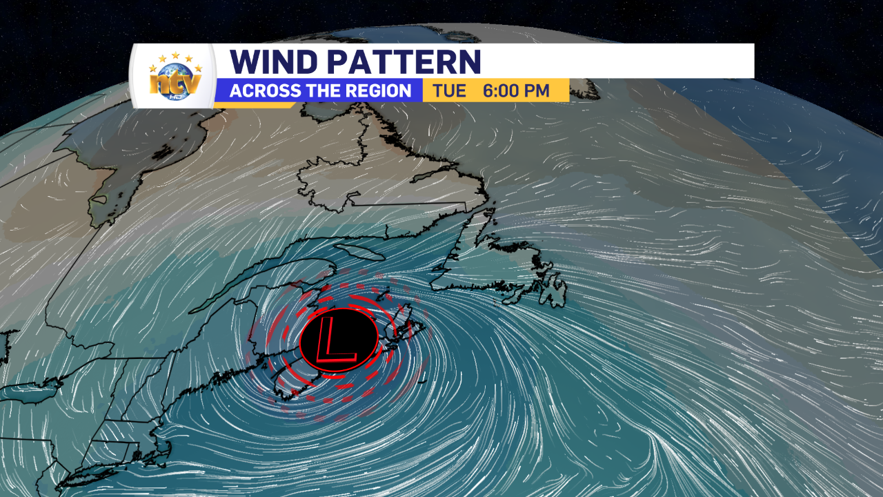
The weather pattern that we’re in is one that’s driving rain, drizzle, and fog across a large part of the Province. This current bout is being brought to use by an area of low pressure over Nova Scotia, that’s going nowhere fast. North of the low we’re seeing the rain, and broad easterly flow, which is helping to push very dense fog onto the eastern part of the Island.
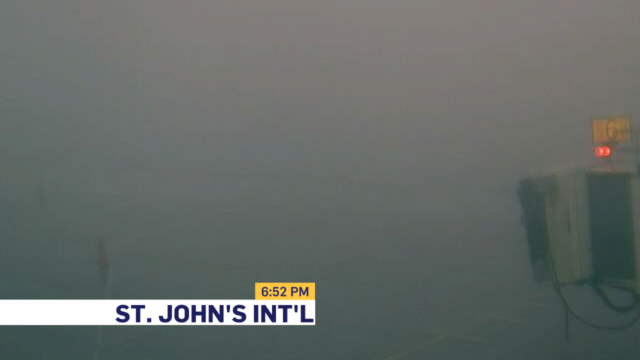
The fog today has been quite dense, and will likely remain that way into Wednesday. Visiblity at St. John’s International Airport has been as low as 600 feet today. This is at the very limits at which the CAT III ILS can be used. 600 feet is extraordinarily low and doesn’t happen very frequently. If you’re going to be flying tonight or tomorrow morning, be sure to check with your carrier. Anything under 1200 feet can cause issues.
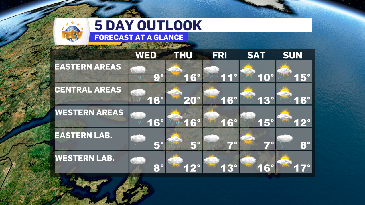
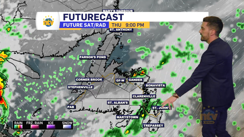
Wednesday will see more showers across much of the Island, with highs of 10 to 15. There may even be some sunny breaks, late in the day, east, central and west. The exception will be on the Northern Peninsula, where rain will continue throughout the day. Southern parts of Labrador will also see rain for much of Wednesday.
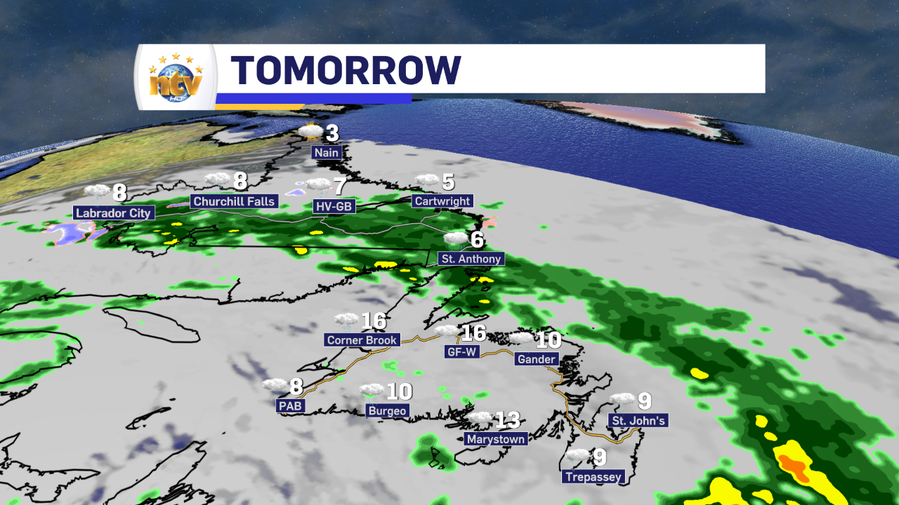
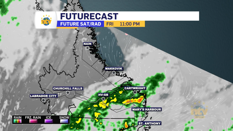
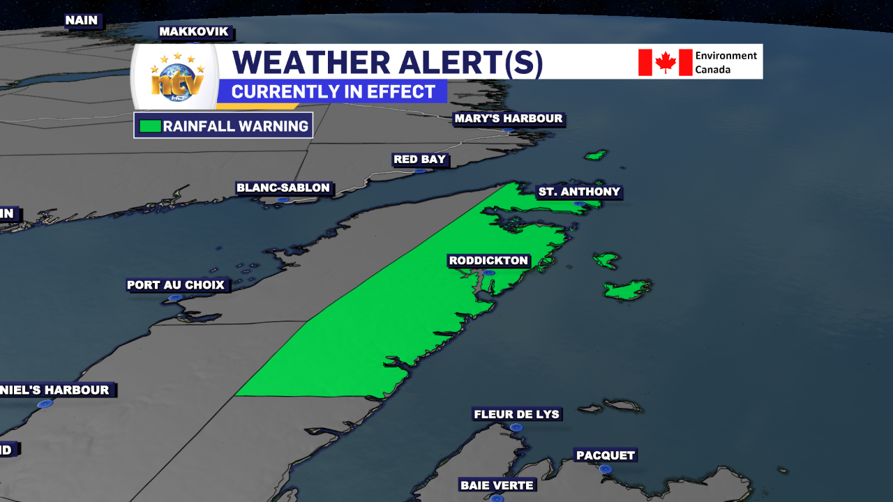
The rain will continue on the GNP and into Southern Labrador through Wednesday and into Thursday or early Friday. Rainfall amounts in some areas will be well over 50 mm. Some guidance indicates close to 100 mm may fall just south of St. Anthony. Because of this, a Rainfall Warning has been issued for the Northern Peninsula East by ECCC NL.

Thursday is shaping up to be the best day of the week across much of the island, with highs in the mid-teens to 20s and some widespread sunshine. There will be some pop-up showers by afternoon over the interior… with perhaps even a rumble of thunder or two.
Beyond that… the weather pattern isn’t as bad as it’s been. But it’s not great either. Hopefully, we will get into a more summer-like pattern before the actual summer arrives in a couple of weeks.