Newfoundland Forecast
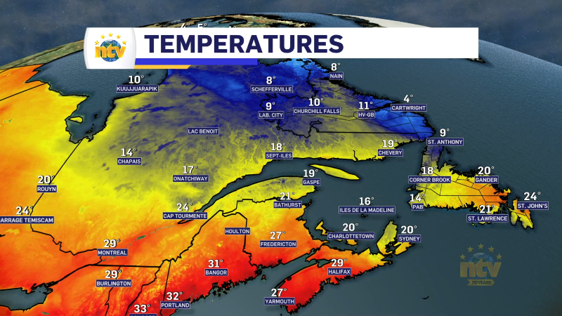
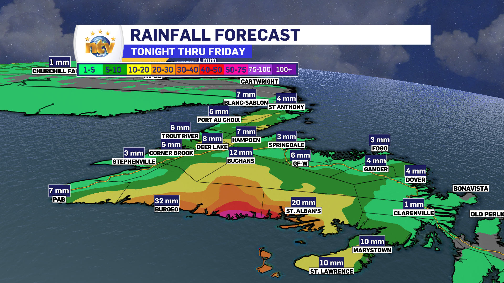
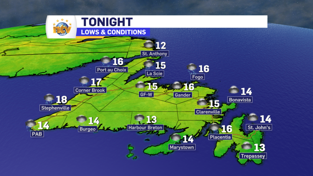
Showers will continue to fall over portions of southern, western, and interior Newfoundland overnight. Farther north, and east, it looks to remain dry overnight. Fog patches will develop for some coastal areas overnight, especially south. Lows will be in the mid-teens, across the board.
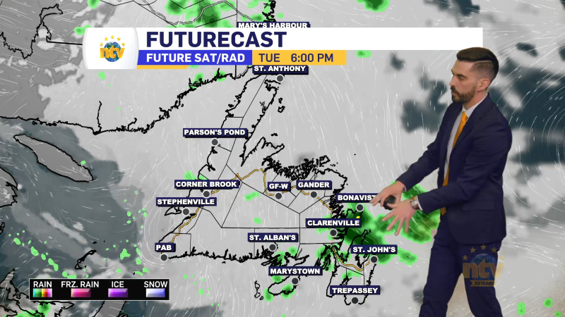
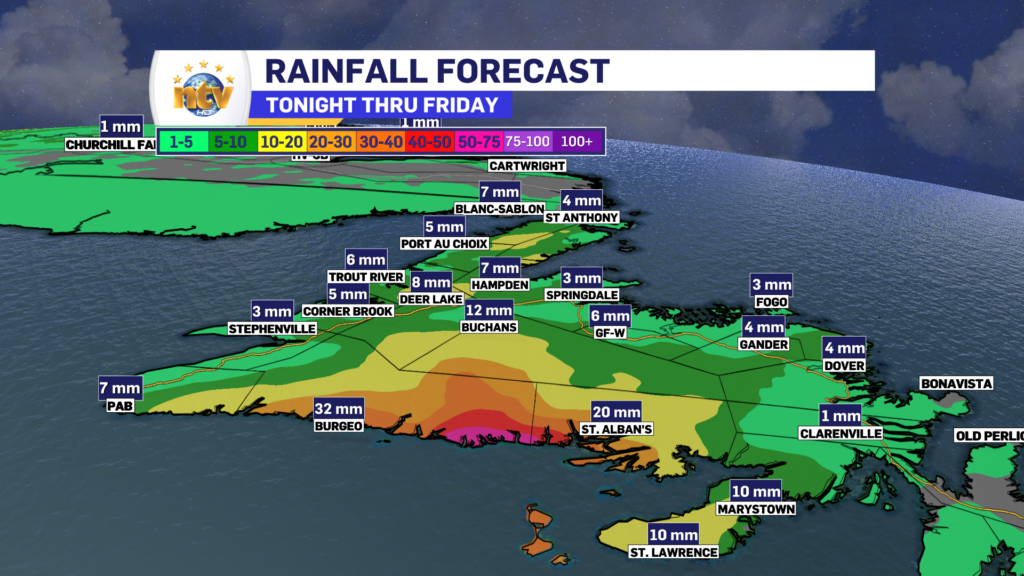
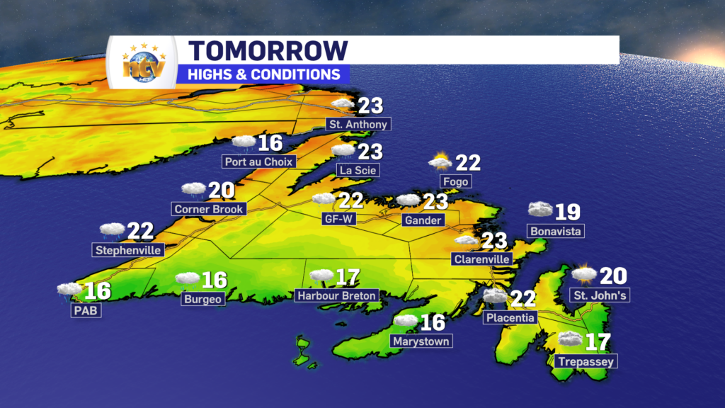
An area of heavy rain will arrive on the South Coast early Friday morning. There may even be some thunderstorms in that as well. That area of rain will move northward during the day Friday.
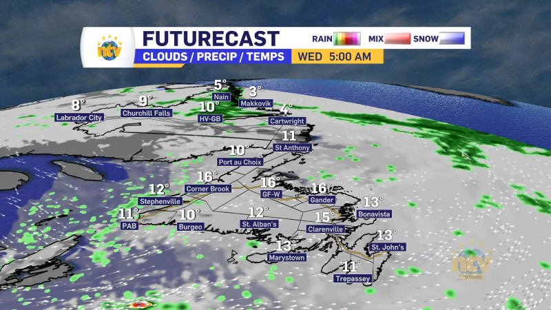
An area of rain will move from the South Coast, through interior Newfoundland into Central and toward the coast during the day. The rain will end on the South Coast late morning, and arrive in Central for the afternoon.
Areas of the West Coast, the East Coast, and the Great Northern Peninsula will largely miss this rain. However southern areas will likely see drizzle, clouds, and fog patches. Highs will be into the teens and 20s
Looking ahead to the weekend, we will see less in the way of widespread rain, but showers will remain in play for the Central, interior, and western sections of the Island. Eastern areas look to remain primarily dry. Temperatures will be in the mid to upper 20s north and upper teens south. Southern areas will remain in onshore flow, so fog and drizzle will persist.
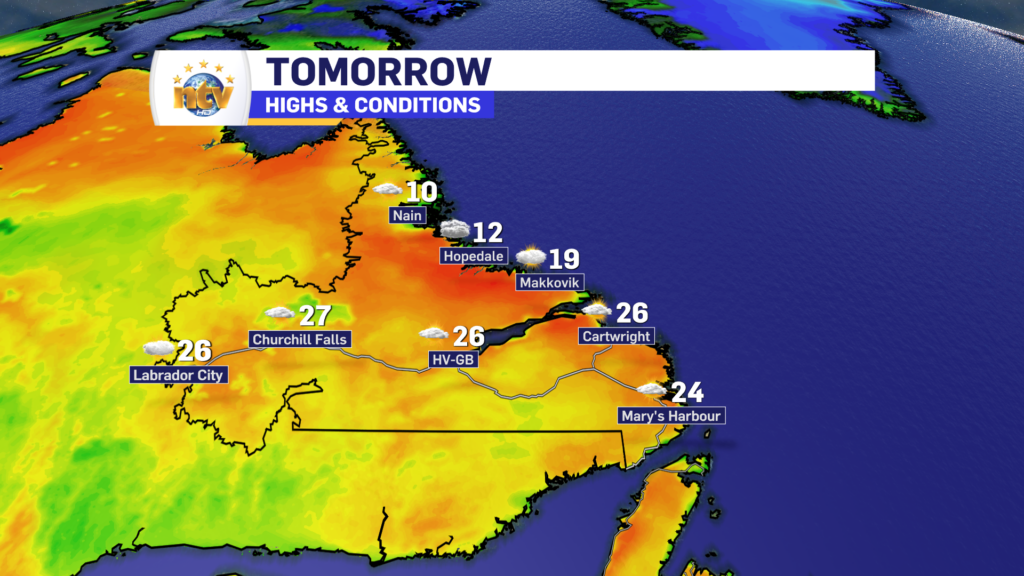
Labrador’s Forecast
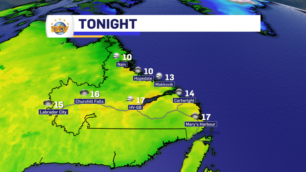
A quiet night is on tap, with lows into the teens. There may be some scattered showers early in the west.
Friday will see dry conditions across the Big Land, with highs in the 20s. The exception will on the North Coast, where the onshore flow will drive temps into the lower teens for highs.
The weekend, and into next week, will see more of the same with respect to temperatures. And at the moment there look to be no major weather makers. However, there will be isolated to scattered afternoon showers and thunderstorms. These storms have the potential to spark new fires from dry lightning strikes. That’s something we will have to keep a close eye on over the next several days.
FIND YOUR LATEST FORECAST, AND USE OUR NEW INTERACTIVE RADAR!