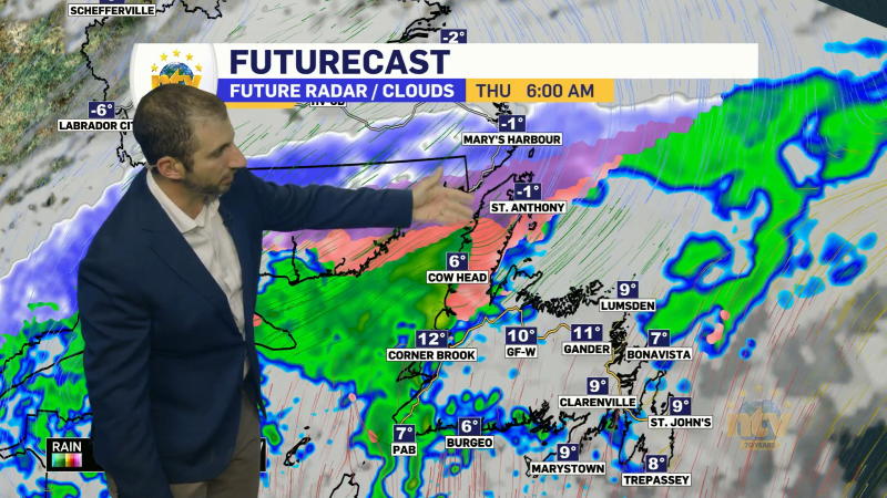
An area of low pressure will swirl its way into Labrador overnight and stall there tomorrow. While this storm system will not drive heavy amounts of snow over large regions in the Province, it will bring some very high wind speeds to the West Coast and South Coast overnight. Environment Canada has issued Wind Warnings for the area and a Wrekchosue Wind Warning. These are in effect for the overnight and will be ended Thursday morning.

The timing of the high wind speeds will vary throughout the overnight, with areas in the south seeing them first and areas farther up the west coast seeing them after midnight. The video below shows the timing of the high wind speeds overnight into early Thursday morning.
Snow will fly in parts of Labrador overnight into Thursday, as much as 25 or 30 cm will fall in some areas of the south and west. On the Island, the snow will fly overnight before ending Thursday morning as rain or drizzle. Amounts will generally be less than 15 cm, with some areas seeing less than 2 cm. The snowfall maps below show that well. Click them to expand!


Temperatures will rise overnight for much of the Province as warmer air works in from the Maritime Provinces. Temperatures tomorrow will generally hold where many of us start the day, which will be in the lower single digits on the Island and near freezing to minus 10 in Labrador.

The weather will be quiet for Friday and Saturday before the next low arrives Saturday night and Sunday. This will bring more snow to Labrador and more messy weather to the Island, in the form of rain and snow, or just plain old rain. Along with that will come another surge of mild air.

-

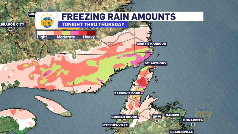
Rain, snow and ice expected over GNP, southeast Labrador late Wednesday into Thursday
A multi-impact weather system is expected to affect parts of Newfoundland and Labrador from Wednesday…