
The Overview
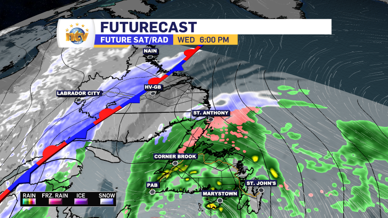
An area of low pressure will swirl its way toward Labrador overnight and will spread rain throughout much of the Big Land before sunrise Thursday morning. The exception will be on the coast, where the rain will hold off until post-sunrise.
On the Island, the large area of high-pressure offshore will keep the easterly flow going overnight. Due to that being the case, cloudy skies will be the norm, with areas of drizzle and fog along and near east-facing shores.
Lows on the Island will be in the lower to middle teens. Labrador will see lows of 5 to 10.
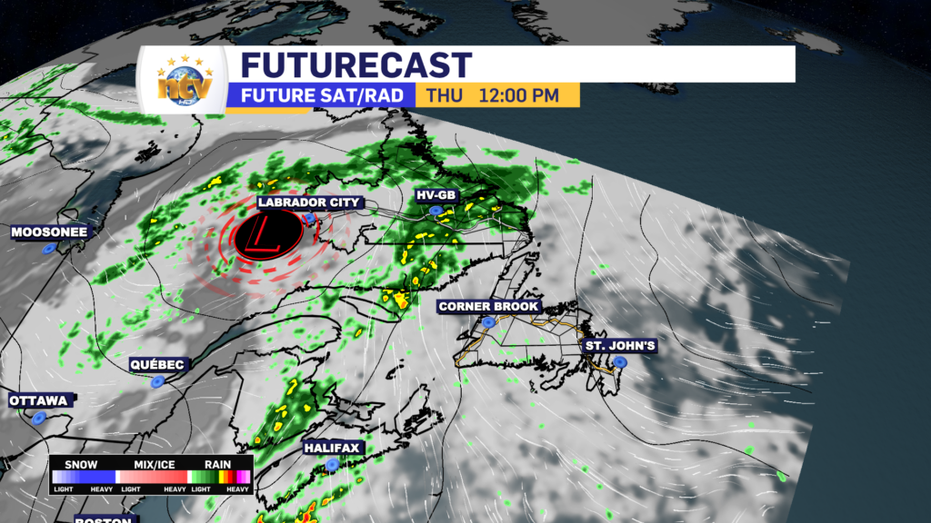
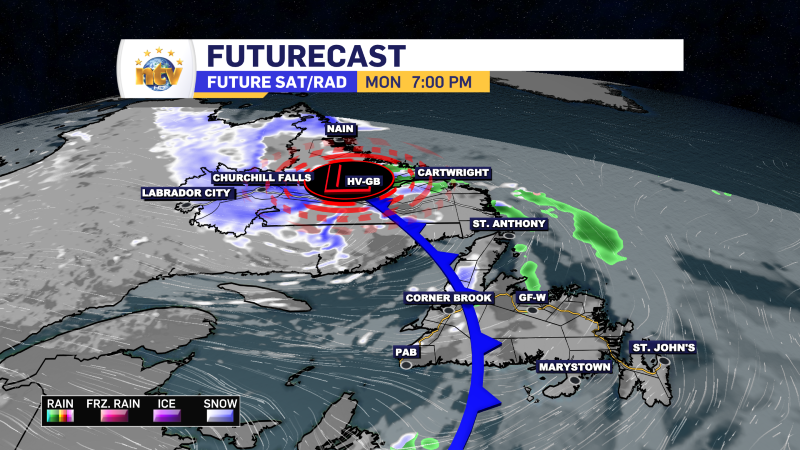
The area of low pressure will continue its journey through Labrador tomorrow and more rain will fall across the area. There may even be some isolated thunderstorms near, and east of, the low. Highs in the Big Land range from 13 to 17.
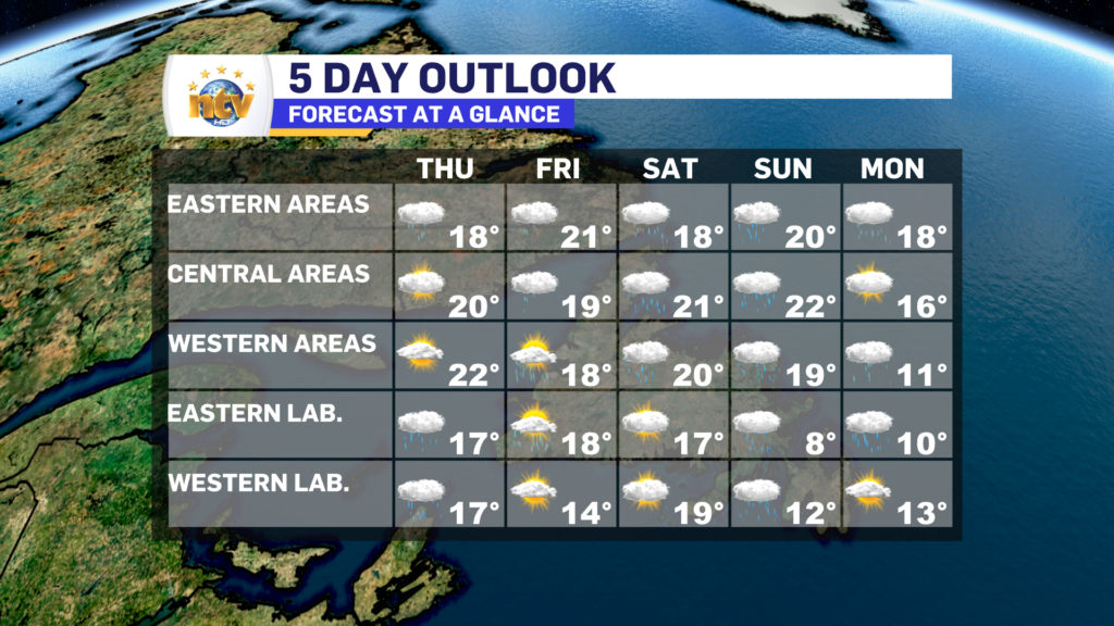
The winds will turn a bit more southerly on the Island tomorrow, which will allow for a shift in the fog and drizzle to southern shorelines, although eastern areas will likely still see some of it. Clouds will be the rule. once again. Highs will be in the upper teens to near 20°.
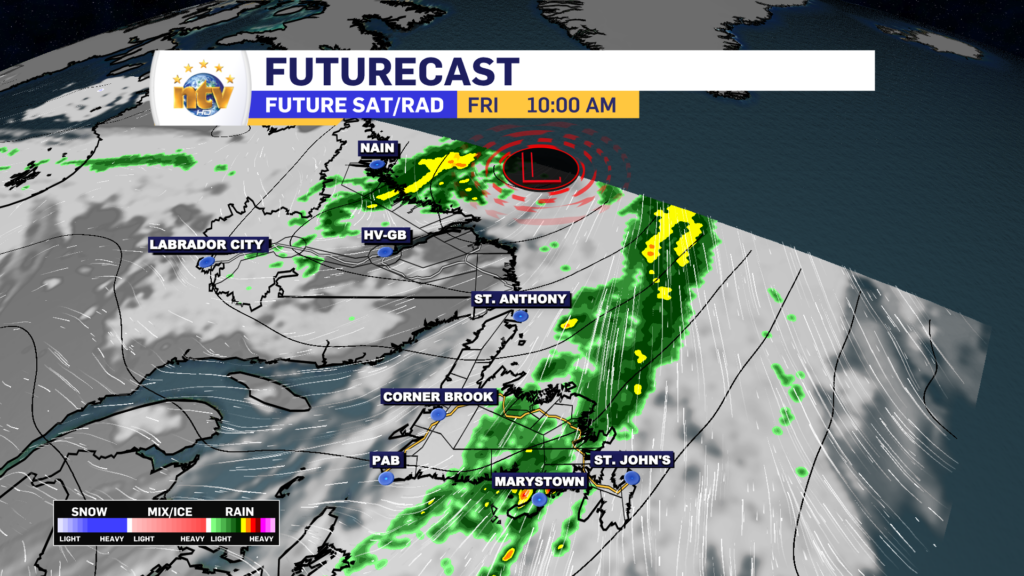
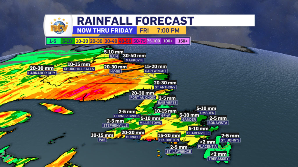
Friday will see the rain taper off in Labrador by mid-morning, while the Island will see rain through much of the day from a narrow band. That band will depart the west coast in the morning but will keep the rain ongoing through Central and Eastern into the afternoon. Highs creep into the lower 20s and sunshine will be hard-pressed to be found. Labrador will see highs in the middle to upper teens.
Temperatures won’t move much for the weekend, and rain is in the forecast for much of the Province as the remnants from Hurricane Lee make their approach.
I’ll have an update on Lee posted to ntv.ca shortly and will link to it in this story once its up!
